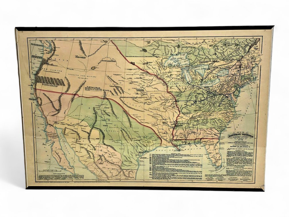
#116 • **B&O Railroad's "Map of the American Colonies and Adjacent Country as Known in 1776" Promotional Item
Part of July 2026 Art Auction (timed auction by Alaska Premier Auctions & Appraisals)
High bid $40.00
Status: SOLD
Category: Maps
A historical map entitled "Map of the American Colonies and Adjacent Country as Known in 1776" (often abbreviated as "as known in 1770"), drawn, engraved, and printed by Asher & Adams. While the map depicts the geography of the late 18th century, it was actually produced in 1875 (or 1876) as a promotional item for patrons of the Baltimore and Ohio Railroad (B&O). Text in the lower left quadrant reads: At the time the maps from which this is a compilation were made, very little was accurately known of the topography of the country west of the Alleghenies and it is difficult to locate precisely the site of what are now large and growing cities. The position of those given in the list below – see numbers upon the map – are therefore only approximately correct. 1. Cumberland. 2. Pittsburg. 3. Grafton . 4. Wheeling. 5. Newark. 6. Chicago Junction. 7. Chicago. 8. Parkersburg. 9. Cincinnati. 10. Louisville. 11. St. Louis. 12. Columbus, O. 13. Washington, D.C. 14. Lynchburg. 15. Danville. Text along the bottom reads: Drawn Engraved & Printed by Asher & Adams 59 Beekman St. New York. Entered according to Act of Congress in the year 1875 by Asher & Adams in the Office of the Librarian of Congress at Washington. Text lower center lists Historical Notes dated from 1497 when John Cabot and his son discovered Labrador through 1867 when Russia ceded Alaska to the United States for $7,200,000, along with notes about the founding of Jamestown and the origianal colonies. Text lower right includes the Map title, "Map of the American Colonies and Adjacent Country as Known in 1776 / Compiled by permission of the American Geographical Society, New York, From works in their possession and Presented to its Patrons by the Baltimore and Ohio Co." The heavy black lines on the map represent, in part, the Post Routes and the National Road, constructed by the United States Government. The text further details information about the B&O Railroad lines, track, locomotives, and services offered at the time, plus names of the regional ticket agents and Master of Transportation. Measures approximately 24" x 36" overall. ** Updated 7/9 @ 10:25 am to include additional transcribed information from the map's text.